


The Australian Capital Territory (ACT) is the capital territory of the Commonwealth of Australia and its smallest self-governing internal territory. It is an inland enclave in New South Wales, situated in bushland.
Sydney is the most populous city in Australia, with a metropolitan area population of over 4,200,000 people, and 151,920 within the city centre.
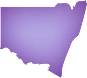
The Central West region refers to the area west of the Blue Mountains, New South Wales. It has a population of 172,790 people, and is the largest region in New South Wales with an area of 63,262 square kilometers
The Far West region of New South Wales, Australia refers generally to a fairly flat and low lying area in the western part of the state, which is too dry to support wheat or other crops or intensive pastoral.
The Illawarra is a region in the Australian state of New South Wales. It is a coastal region situated immediately south of Sydney and bounded Shoalhaven region in the south, and encompasses the city of Wollongong and Lake Illawarra.
The Central Coast is an urban region in the Australian state of New South Wales, located on the coastline north of Sydney and south of Lake Macquarie and Newcastle.
The Hunter Valley is a region of New South Wales, approximately 160 kilometres north of Sydney with an approximate population of 700,000 people, most of which live in the Newcastle metropolitan area.
The Mid North Coast is a country region in the north east of the state of New South Wales. The region covers the mid to north coast of NSW, beginning at Seal Rocks, 275 km north of Sydney, and extending as far north as Woolgoolga, 562 km north of Sydney, a distance of roughly 400 km (300 miles).
The Northern Rivers refers to the part of the North Coast, which lies north of the Mid North Coast region of New South Wales. It lies between the Pacific Ocean, the eastern escarpment of the Northern Tablelands (New England) and Queensland in the valleys of the Richmond River and Tweed River. It has a mild, sub-tropical climate.
New England is the name given to a region in the north of the state of New South Wales. The two traditional centres of New England are Armidale and Tamworth. Armidale is the home of the University of New England, Australia's oldest regional university. Tamworth is now known as the centre of Australia's country music industry.
The North West Plains region of New South Wales, Australia refers generally to the area to the west of New England region, to the north of the Central West region and to the east of the Far West region. The region corresponds generally to the Australian Bureau of Meteorology's forecast area of North West Plains and Plains.
The Southern Highlands is a geographical area in New South Wales, Australia, 103km southwest of Sydney. It sits between 500 and 900 metres above sea level. Like other regions along this plateau such as the Blue Mountains to the north and the Australian Alps to the south, the Southern Highlands is known for its cool climate.
The Snowy Mountains (known for short as the Snowies) are the highest Australian mountain range and contain the Australian mainland's highest mountain, Mount Kosciuszko, which reaches 2228 metres AHD.
The Riverina is an agricultural region of south-western New South Wales (NSW), Australia. The Riverina is distinguished from other Australian regions due to the combination of flat plains, warm to hot climate and an ample supply of water for irrigation.
Melbourne is the second most populous city in Australia, with a metropolitan area population of approximately 3.8 million (2007 estimate). Located around Port Phillip Bay in the country's south-east, Melbourne is the state capital of Victoria.
The Yarra Valley is the name given to the region surrounding the Yarra River in Melbourne, Australia. The river originates in the Yarra Ranges approximately 60 kilometres east of Melbourne and flows towards and into the city of Melbourne and out into Port Phillip Bay.
South East Victoria, or Gippsland region, is a nature lover's paradise with stunning mountains such as the Snowy River country, more than 20 national parks, rocky rivers, forests, gardens and long, sandy beaches.
West Victoria, also known as the Central Highlands, contains the important wheat-growing area of the Wimmera, which has some of the best farmland in the State.
North West Victoria, also known as the Loddon-Mallee, features stunning contrasts from the Mediterranean-style climate, orange groves and vineyards of Mildura, to the remarkable desert national parks.
North East Victoria, otherwise known as the Goulburn Ovens Murray region, includes the regional centres of Wangaratta, Shepparton and the city Wodonga. North East Victoria is within a three-hour drive from Melbourne.
South West Victoria, also known as the Barwon-Western region, offers a seaside atmosphere, country living as well as the benefits of city life in its major towns.
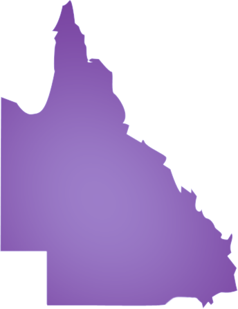
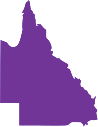
Brisbane is the capital and most populous city of the Australian state of Queensland, as well as the third largest city in Australia. It is set close to the Pacific Ocean, and is situated beside the Brisbane River on plains between Moreton Bay and the Great Dividing Range in south-eastern Queensland.
Located on Queensland's coast, the region's economic advantages spring from its rich mineral deposits, a bountiful supply of tourist attractions, large selections of industrial land, a strong marine sector, a skilled engineering trade-related workforce and a well established infrastructure base.
The Fitzroy region is a popular holiday destination. The region's economy is heavily dominated by coal mining, and cattle grazing. A major aluminium smelter is located in Gladstone. The region has a population of 187,916 people.
The Mackay region is centred on the coastal city of Mackay and extends some 300km inland. It contains the Whitsunday Islands group and the coastal towns of Proserpine, Bowen and Sarina. The coastal areas are densely covered in sugar cane farms, while the less densely populated inland areas have several mining communities.
The Northern region is a coastal region and a location of major seaport handling exports from mines in Mount Isa and cattle exports. The region also contains a bulk sugar exporting terminal at Lucinda in the region's north. It also contains the inland city of Charters Towers and the coastal towns of Ayr and Ingham.
Far North Queensland is a region of Queensland covering the northern part of the state. The region contains a large section of the Tropical North Queensland area. Far North Queensland covers an area stretching from the city of Cairns to the Torres Strait at the northern most part of the State.
The North West region is located along the Gulf of Carpentaria coast. The region's terrain is mostly arid or savannah country. The major city in the region is Mount Isa with a population of approximately 20,000.
The Darling Downs is a farming region on the western slopes of the Great Dividing Range in southern Queensland, Australia. The downs are to the west of South East Queensland and are one of eleven major regions of Queensland.
The North West Tasmania region covers a vast area including the towns of Devonport, Burnie, Strahan and Queenstown as well as Cradle Mountain National Park. The gateway to this region is Devonport, with an airport and the Spirit of Tasmania (ferry between Victoria and Tasmania) terminus.
This is a region of surprising variety - from neat croplands of Scottsdale and Ringarooma to the natural habitats of Mt William, where forester kangaroos graze; from tall, tumbling waterfalls in deep rain-forest to warm sunshine on white sand.
From Granton where the Bridgewater Bridge crosses the Derwent north of Hobart, explore the Lyell Highway as it follows the course of the river past poplars and willows, hopfields and orchards, towards Tasmania ’s mountains and wilderness.
Hobart is the state capital and most populous city of the Australian island state of Tasmania. Founded in 1804 as a penal colony, it is Australia's second oldest and eleventh largest city, with a metropolitan population of approximately 202,000.
Tasmania’s west coast is still wild and rugged. As you travel west along the Lyell Highway through the Franklin-Gordon Wild Rivers National Park or south from Devonport you know you are entering an ancient landscape.
Adelaide is the capital and most populous city of the Australian state of South Australia, and is the fifth largest city in Australia, with a population of over 1.1 million in 2004. It is a coastal city beside the Southern Ocean, and is situated on the Adelaide Plains
Flinders Ranges is South Australia's largest mountain range 384 km north of Adelaide. Parts of the ranges are national parks. It stretches over 430 km from Port Pirie to Lake Callabonna.
The Yorke Peninsula is a peninsula located north-west and west of Adelaide in South Australia, Australia, between Spencer Gulf on the west and Gulf St. Vincent on the east.
Darwin is the capital city of the Australian Territory of the Northern Territory. A population of just over 105 thousand makes it by far the most populated city in the sparsely populated Northern Territory but the least populated of all Australia's capital cities.
Kakadu National Park is in the Northern Territory of Australia, 171 km east of Darwin. Kakadu National Park is located within the Alligator Rivers Region of the Northern Territory of Australia. It covers an area of 19,804 square kilometres, extending nearly 200 kilometres from north to south and over 100 kilometres from east to west.
Katherine and surrounding areas are situated 320 km southeast of Darwin in the Northern Territory of Australia. It is the third largest settlement in the territory after the capital Darwin and Alice Springs.
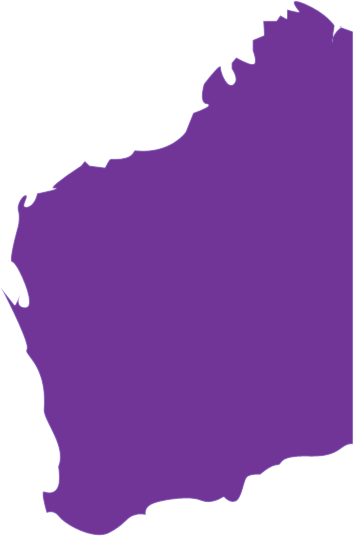
Perth is the capital of the Australian state of Western Australia. A population of 1,507,900[1] (2006 estimate) makes Perth by far the largest city in Western Australia. The city is also the fourth most populous urban area in Australia, and with a growth rate of 2% is currently the fastest growing major city in Australia.
The South West region is one of the nine regions of Western Australia. It is so named because it located in the south west corner of Western Australia. The South West region has an area of 23,970 km², and a population of about 123,000 people.
The Great Southern region is one of the nine regions of Western Australia. It is made up of the south coast of Western Australia and neighbouring agricultural regions. It is officially comprised of the local government areas of Albany, Broomehill, Cranbrook, Denmark, Gnowangerup, Jerramungup, Katanning, Kent, Kojonup, Plantagenet, Tambellup and Woodanilling.
The Goldfields-Esperance region is one of the nine regions of Western Australia. It is located in the south eastern corner of Western Australia, and comprises the local government areas of Coolgardie, Dundas, Esperance, Kalgoorlie-Boulder, Laverton, Leonora, Menzies, Ngaanyatjarraku and Ravensthorpe.
The Mid West region is one of the nine regions of Western Australia. It is located on the west coast of Western Australia, extending about 200 km north and south of its administrative centre of Geraldton. It has a total area of 472,336 km², and a population of about 52,000 people.
The Gascoyne region is one of the nine regions of Western Australia. It is located in the north west of Western Australia, and consists of the local government areas of Carnarvon, Exmouth, Shark Bay and Upper Gascoyne.
The Pilbara is a region in the north of Western Australia. It is one of nine regions of the Regional Development Commissions Act 1993, and is also a region under the Interim Biogeographic Regionalisation for Australia (IBRA).
The Kimberley is one of the nine regions of Western Australia. It is located in the northern part of Western Australia, bordered on the west by the Indian Ocean, on the north by the Timor Sea, on the south by the Great Sandy and Tanami Deserts, and on the east by the Northern Territory.



Enter suburb, post code, or property ID:
| Agent | |||
| Type | |||
| Suburb | |||
| State | |||
| Price | to | ||
| Area(m2) | to (m2) | ||
| Parking | Security | ||
| Disabled Access | 3 Phase Power | ||
| Rail Access | Air Conditioned | ||
| Services | Industrial | ||
| Retail | Professional |
A true Rentalz resource for tenants and agents allowing speedy uploads from agents desktop system to the web and no double handling. Tenants can rely on the information being current and up todate. Agents can quickly add and remove properties from their desktop trust account they use every day.